About a year ago I took the plunge and got a new phone and new contract with Cingular. I loved my new phone and the plan I got was about the same as my old one, so I was pretty happy. Then, after just a few months, my phone started having an issue where it wouldn't ring anymore. It turned out that this was a common issue with all phones like mine, and it just required a firmware update. However, Cingular's method of updating the firmware is to send you a replacement phone and take the old one back. OK, fine.
Except, the replacement phone they sent me wouldn't even turn on reliably. I called them up, and they said, ok, fine, here's another phone. Luckily the 3rd phone worked, and I sent back my 1st and 2nd phones.
Fast-forward to November (phone worked great until then). All of a sudden my phone freezes up occasionally. Pushing the buttons has no effect. Sometimes I had to take the battery out to reboot, sometimes it resolved itself. I called up Cingular and they say it's a phone problem. Lucky for me, my phone is STILL under warranty. So they'll send me a new one.
A 4th phone of the same model? I ask them - Doesn't that seem like I'm asking for it again? No problem they tell me, you can pick a new one of these 4 models (LG CG300, Motorola V557, Nokia 6103, or Sony Ericsson W300i). So, in a miraculous bout of decisiveness on my part, I manage to pick a new phone - the Sony Ericsson W300i, one of Sony's "Walkman" phones (we've come a long way from portable tape players...). I decided to stick with Sony Ericsson because I have their chargers and I like their interface. As an added bonus for my troubles, I also got a car charger.
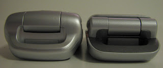
The W300 arrived a few days later and I have to say I like it quite a bit. It's nearly identical to my old phone (the Sony Ericsson Z520a) in many ways - the menu system, the crappy camera, the button layout, the infrared port for file transfer - but also has some improvements. For example, it doesn't have the take-a-picture-of-the-inside-of-my-pocket button. Instead it has the Walkman button and volume controls there. It also has an FM radio if you plug in the headphones that come with the phone (they act as the antenna). The reception so far has been pretty decent! Furthermore, you can load mp3s onto the phone's internal memory or a Micro Memory Stick (up to 1 GB so far) and listen to those too. It's like my own iPod Shuffle! The battery life is long (9 hours of talk time), so using the music features shouldn't drain the battery instantly (and thus far hasn't been an issue). And despite its slightly larger size (see photos below), the W300 is actually a bit lighter than the Z520a.
A few things I liked better about my old phone: the keypad buttons were easier to push, and the center button of the 4-way controller went to the menu instead of the Web (and thus charges everytime you accidentally push it), and the earpiece was actually more functional because it coveres a larger surface area instead of being 3 small holes. And sadly, the speakerphone function on the W300 is fairly hard to hear - ironic, since it's supposed to be a phone with good sound quality for music listening.
Here's a review (from whence the title of my post came), and here are some photos I took comparing the two phones before I returned the Z520a. The W300i is on the left, Z520a on the right. Happy calling!
Monday, December 11, 2006
Saturday, December 02, 2006
New Whole Foods
After nearly two years of waiting (since we moved into our building), the Whole Foods on Westlake and Denny finally opened. I went there with pl on the first weekend it was open, and damn, produce never looked so good. We whipped out the cameras and were having a heyday - till an employee informed us that Whole Foods does not allow photography on the premises and that we should go over to customer services (presumably to erase the memory cards?). The latter part was thankfully not enforced. After a delightful sandwich from the deli counter (a bit more emphasis on the pre-made sandwiches than at the Roosevelt location), consumed at a table hard-won in the puny eating area, we ventured back out into the rain (it was November, after all), stopped by the new Starbucks on the upper level of the same complex (we are Seattleites, after all), and then went back to work (we are graduate students, after all).
Wednesday, November 29, 2006
Pure Genius
As I was walking through the B terminal of the SeaTac airport yesterday, I spotted this interesting contraption, the "chargecarte" - it's a machine that you use to charge your cell phone. It has slots for all of the major phone manufacturers. It makes a lot of sense- people forget to bring cell phone chargers all the time. When you need one, you really need one. Looks like it's made by the SmarteCarte people - you know, the ones who give you $0.25 back when you return the luggage cart that you rented for $3. Somehow, at $3 for 30 minutes, the price for this device actually seems surprisingly reasonable, especially given its utility!
Tuesday, November 21, 2006
Speaking of lightning...
A few years ago we had a fantastic lightning storm here. I spent a long time out on the balcony desperately trying to take pictures of the storm with my old Fuji digital camera. The camera could only go down to 1/4 of a second, and had no manual focus, so it was perpetually unhappy about the adventure. After some hundreds of completely black images, I did manage to catch a few pictures of lightning - this one originally looked like a mostly black picture with a small white line in the lower right, but some photoshopping by pl (thanks!) really brought out the details. Guess I should have used a tripod though, eh? Were such a storm to happen again I think I'd be able to get a better shot with my current camera - but storms are quite rare here, so I may have to wait a while longer :)
Seattle, MI?
Today my labmate tr and I ventured outside the building for lunch, determined to finally check out the newly relocated Dexter Deli [bwst]. After eating (I had a turkey sandwich - perfectly edible, a nice change of pace, though nothing to really write home about...) we looked outside and noticed it had started to rain. Then there was some lightening and a crack of thunder fewer than 5 seconds later. (tr, being from the midwest, scoffed at the paltry thunder and lightning.) Well, we thought to ourselves, best get back to lab before it starts raining harder. Heh. Apparently the gods were putting us in our place for daring to actually take a lunch break because no sooner did we get about a block down Dexter before the skies opened up and started pelting us with hail! Sideways hail, about the size of peas, and it HURT. We started running, but had to wait at a stoplight, so hid behind a telephone pole to escape the ravaging storm. By the time we made it back to the lab, my jeans and shoes were soaked. Glancing out the windows at the streets below we noticed that there were mini icebergs floating down the gutters of the inundated streets. Definitely crazy weather. Some 10 or 15 minutes later the storm abated for the most part. KOMO4's webcam managed to capture some of the excitement - not every day you see a shot like this.
Thanks to Samantha at metblogs for the link to the photo.
Thursday, November 16, 2006
Stamps
Tuesday, November 14, 2006
The Windy City
Note to those who are as naive as me: if you're walking around Chicago on a windy afternoon, freezing your butt off as the wind whips between the buildings and makes you shiver to your core, and you decide to remark that Chicago's nickname sure is apt, you WILL get pounced on and told by anyone "in the know" that, in fact, that nickname did not arise because of Chicago's most famous weather pattern. Instead, it originated from olde-tyme Chicagonians' love for telling long stories (i.e., long-winded). Huh? I'm SURE that the irony of the nickname was not lost on whoever came up with it, but come on, it's WINDY there! Like, air moving fast, cold air at that, blowing your hair around, pushing you over, making the trees sway, WINDY. Sheesh.
That said, I spent a few days in Chicago last month for the BMES conference, which meant I didn't see much of the city except for the inside of the conference hotel for the majority of the time I was there. Luckily I had a little time after the conference was over to explore before flying home. I checked out the "Bean" - i.e. the Gehry structure at Millenium Park (see pic above), and also walked the "Mag Mile" - Michigan Avenue. I then turned south, but along the lakeshore, and walked down to Navy Pier and eventually down to Grant Park before heading north again to complete my loop. I was disappointed to miss the Art Institute - it came highly recommended - so I will have to go there the next time I'm in the gateway to the midwest. I also didn't have time to make it to the Sears or Hancock towers.
I was also fortunate to be in the company of people who grew up in Chicago, so I managed to get some great food while I was there! Italian food was wonderful at both Rosebud on Rush and Club Lucky. Giordano's for pizza tasted alarmingly like Delfino's - go figure. Lunch at Potbelly Sandwich works (twice!) was awesome (and so much better than the truly craptacular lunch the conference provided).
As for the bean, I actually went there twice - once in the evening and again the following day. As I first approached it, I thought it was enormously overrated - till I came within about 20 feet of it, and then it became obvious that it really was all it was cracked up to be. Ond of the neatest things about it is that if you stand underneath the curved part and look up, it looks like you are standing at the bast of a long cylindrical shaft - when in reality it's just a smooth surface. The picture only sort of conveys this phenomenon.
Anyway, the rest of my pics are here.
Wednesday, November 08, 2006
Transit of Mercury
Today is a rare celestial event - Mercury is passing in front of the sun (the small circular dot in the lower left portion of the sun in the above image). If the sun was actually out and if I had a solar filter and a telescope, I could be viewing it myself. But instead, I'll just have to be satisfied with images from the SOHO satellite.
Monday, November 06, 2006
More rain news
Interesting blog entry from the Washington Trails Association about the rain/flooding today. The crazy thing is, there has only been about half as much rain today as there was that day in October of 2003. Sure doesn't feel like it.
They weren't kidding.
It's been doing nothing but rain for the past few days... and hard rain at that. Hence, flooding imminent.
Thursday, November 02, 2006
Friday, October 27, 2006
Orca watching
One of my best friends from college (sns) came up to visit me the last weekend of September, so we thought it would be fun to take a whale-watching tour. The boat departed from Anacortes a bit later than normal because they'd had a private group come through earlier in the day.
We got geared up - which meant full-body "comfort suits" to keep us warm, and then got assigned seats on the boat. We were on the high-speed boat so our trip would only be 3-4 hours instead of 5-6. Luckily, sns and I got seated near the front.
Our guides had heard from other people in the know that the pods were hanging out up in the Strait of Georgia - practically even with Vancouver (in Canadian waters!). So away we went, up the Rosario Strait, past Orcas Island, and up up up. That part of the ride wasn't super exciting. I kept thinking I was seeing dorsal fins, when really it was just more waves in the water.
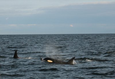
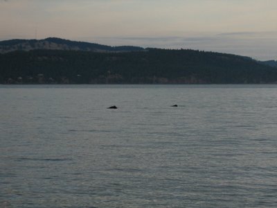
Finally we caught up with the "southern resident pods" - there were three pods all hanging out together. Apparently they were in some kind of hurry because they moved right by us pretty quickly. We followed one pod for a little bit, then let it go by and waited for the next one. The guides said there were 90 whales in the area - I think we probably saw 30 or so. Not bad!
After the last pod had passed by, we had to head back to Anacortes. We had ventured out some 60 miles or so, which was only possible because we were in "the fastest boat in the Washington whale watching fleet". Nonetheless, we still had to high-tail it back to beat the setting sun. Instead of coming back the way we came, we went through the San Juan Islands. We ran into some Dall's porpoises en route, just before we passed back into US waters.
As we passed by Spieden Island, we got to see some of the resident Fallow Deer and Mufont Sheep. Apparently some guy used to own the island and brought those species to it so he could hunt them. Now they just roam around. We also spotted a harbor seal shortly thereafter.
The sunset was spectacular as we motored on back to the harbor. The rest of my pictures are here. All in all, it was a pretty awesome day!
Wednesday, October 25, 2006
Albertsons update
Monday, October 23, 2006
Marmot Pass
Well, it appears that I'm getting quite behind on my blogging! It was already a month ago that I spent the weekend on a quick backpacking trip up in the Olympics with ks and new friend evw. We departed on Saturday morning after stopping by the lab for a brief cell feeding, and headed down to the downtown ferry terminal, destination: Bremerton. None of us had ever taken the Bremerton ferry before, and it turned out to be really nice! The ferry actually goes into the islands of Puget Sound, sa opposed to just crossing open water and then docking on the other side.
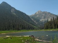
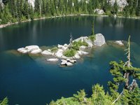
After we unloaded at Bremerton, we drove up to the Hood Canal Bridge and then back down on 101 to the Big Quilcene River. The hike was pleasant - a river walk through lush woods (and this is the DRY side of the Olympics!) before climbing up the side of the valley and along the craggy peaks of Buckhorn Mountain and its neighbors. The fall colors were just starting to turn. When we reached Mystery Camp, we decided that we would set up camp and make dinner and then do some more exploring the next morning, bright and early. Sleep, however, didn't come easily, as there was something large and alive outside our tent for part of the night (I wasn't the only one who heard it - ks did too!).
Needless to say, I didn't get a lot of sleep that night. We evetually got up in the pre-dawn hours, grabbed our breakfast, water, the stove, and the pot, and headed up towards Marmot Pass and beyond. The sun rose on our way up to the pass, and the views of the Cascades and Puget Sound were amazing. We decided to head up further, to the top of Buckhorn Mountain. When we got up to the ridge above Marmot Pass, we could actually even make out the skyscrapers of downtown Seattle! We could also see Mt. Baker, Glacier Peak, Mt. Rainier, Mt. Adams, and Mt. St. Helens. We couldn't see Mt. Hood, but we are convinced it is because it was hiding behind one of the other mountains, perhaps Mt. St. Helens. We could also definitely see a number of peaks in Canada!
Following our summit of Buckhorn Mountain, we stopped to make breakfast (oatmeal all around). I have to say, that was one of the most spectacular places I've ever eaten breakfast before :) When we finished, we made our way back down to the campsite, packed everything up, and headed back towards the car. The first part of the trail was slow-going for me, as I had to keep stopping to take pictures of the beautiful scenery. I'm convinced that the trees got noticably yellower and redder overnight. The sky was perfectly blue. Once we were back in the forest, my shutter quieted down and we made our way back down to the trailhead.
We decided to take the faster Kingston ferry back home, and timed it just right so we could grab a bite to eat at a local carry-out grill place (the sign stated that there were no refunds if you had to leave to catch the ferry before your food was ready). We enjoyed our cheeseburgers and cokes and then boarded the ferry for another spectacular crossing of Puget Sound.
All in all, it was an awesome weekend! As always, you can find the rest of my pictures here.
Friday, October 06, 2006
Leavenworth
A few weekends ago I went out to Leavenworth for the Pathology departmental retreat. The department always puts us up in the Sleeping Lady, which I really like. We listen to science talks and then have a nice dinner (cafeteria style, but with really good food), followed by a scientific poster session and wine and cheese. This year I ended up eating dinner with an old labmate, and it was really great to catch up and reminisce about old times. The poster session was good - I got a fair amount of traffic - but I didn't get a chance to read anyone else's posters. The evening ended, as it usually does, with everyone hanging out at the "Grotto" - the on-site bar.
The next day we had more talks and then were given lunch and let loose. I had been planning to stay out there and camp that night, but it was pretty cold and no one was available to stay with me, so I decided to just go for a dayhike instead. For that adventure I convinced my two labmates ks and jg to come along. We headed up to Eightmile Lake out along Icicle Creek road. We headed up the trail through the open forest - the area has been hit by forest fires from time to time - and then reached Little Eightmile. It wasn't more than a pond, being the end of summer and all, so we headed up another half mile to reach the main Eightmile Lake. It was bigger than I expected - and had some nice craggy snow-dusted peaks surrounding it.
The air temperature was a bit too chilly for my companions, so we spent only a little time at the lake before heading back down. On the way back to the car it started to rain, and then when the sun came out, we had a rainbow right in front of us. It felt like the rainbow was very close - not sure I've ever seen one like that before. The valley to the south was very pretty as well, having been dusted with snow the night before. Before too long we reached the cars and headed back home. I made the (poor) decision to go down 97 to 90 instead of taking 2, thinking it would be faster, but instead was met with a torrential downpour at Snoqualmie Pass. Doh!
Click here for the rest of my photos from the weekend.
Monday, October 02, 2006
Dexter Deli and Sushi Bay
It appears that some change has come to the culinary organization on Dexter north of Mercer. The Dexter Deli, which was previously up by Starbucks, is now down in the new Neptune apartment building. Taking its place at Highland and Dexter is "Sushi Bay" - perhaps a welcome alternative when eating lunch out at work!
Thursday, September 28, 2006
Fall foliage tracker
This is pretty neat - weather.com has a fall foliage tracker. Looks like Washington is still in summer mode, despite these trees on my street being the first on the block to change colors. They are always the harbingers of fall for me!
Monday, September 18, 2006
Gothic Basin
Over Labor Day weekend, my friend lb and I went for a day hike out on the Mountain Loop highway. We decided to head up to Gothic Basin, since I'd recently heard from two different people how great it was up there. It was about 5.5 miles to get up to our destination, but well worth the climb. We were rewarded with striking rock formations, green valleys, tarns, and views of the surrounding peaks. When we first reached the basin we turned left instead of right and wandered down to the point where there was a sheer dropoff of about 1000 feet in elevation down to Weden Lake. Realizing this was not quite right, we backtracked and then made our way to Foggy Pond (frequently mistaken for Foggy Lake). We ended up taking the long way around, passing another pretty tarn with a waterfall on the way, but finally made it up to Foggy Lake. Though I have it on good authority that the lake often lives up to its name, it was in fact beautiful and clear when we were there. We picked our way around the lake so we could find a place to swim, though the swim itself consisted of a quick dunk and rushing back out to the warm rocks due to the frigid water temperature. Finally we turned our boots back downhill and made our way back. Foggy Pond tempted us with its much warmer water, but time was of the essence and we knew we needed to make haste in order to get back to the car before dark (it's not July anymore, Toto!). All in all it was a great hike, worthy of the praise it was given that inspired us to go in the first place.
As an added bonus, we stopped for dinner at the first little restaurant we saw, and were treated to the musical stylings of a Guns N' Roses cover band called Max Axle, complete with dancing groupies. Click here to see the rest of the pictures!
Wednesday, August 23, 2006
Robin Lakes
Many people I know use the Mountaineers' "100 Classic Hikes in Washington" as their hiking bible. It's for good reason: the hikes described in that book are practically guaranteed to be awesome. One of the ones that has stuck out in my mind for a while, but I hadn't had time to do, was #53, Tuck and Robin Lakes. This past weekend, I finally made it up there for an overnight trip with my labmate ks.
We got a bit of a late start - feeding cells in the morning combined with a longer-than-expected drive out beyond Cle Elum resulted in a 12:30 start time. This meant that we were climbing up the trail at the peak of the heat of the day - with packs on - but oh well. The first part of the trail is extremely flat, following the Cle Elum river up to Hyas Lake and Upper Hyas Lake. A little while after passing the lakes, we started heading uphill. The up-ness didn't take many breaks after that. We came to a junction and took a right, towards Tuck and Robin Lakes. I think that the trail up to Tuck was the hardest part - the trail wasn't graded very well, and the dusty steepness was pretty tricky. We stopped for lunch on a flat slab of granite - and also provided some lunch (in the form of our skin) to some local biting flies.
We eventually made it up to Tuck lake, which was quite beautiful. It had some amazing rock islands in the middle of it that I just yearned to swim out to - but alas, it was already after 5:00 and we still had another mile and 1000 feet in elevation to go to get to Robin Lakes.
The trail up to Robin Lakes bordered on a scramble at times. Much of it was marked with cairns as it passed over granite, which doesn't lend itself well to trail-cutting. We passed a group of people who tried to convince us that there were no more campsites left at Robin - but then they admitted that they were just joking. We went around a knob, then up some more granite, then up some more granite, and just when we thought we couldn't take anymore, we came over the crest of the basin and the Robin Lakes came into view. They are beautiful lakes, very different from Tuck and Hyas in that there are far fewer trees (and more granite) surrounding them. Just a tiny bit of snow remained on some of the north-facing slopes.
Since the sun was beginning to set, we knew we had to find a campsite in a hurry. However, since the sun was setting, the light was all pretty, so we kept taking pictures and delaying our progress. Somewhat fortuitously, ks wanted to gain higher ground and climbed up on a bluff, where a perfect campsite was hiding (the rest of the good campsites having been long occupied that day). In between photo ops, we managed to get the tent set up and water purified, and mac and cheese cooked. We ended up eating in the dark, but that was fine.
The stars were out and absolutely amazing - a late rising crescent moon meant we had completely dark skies. I saw at least a half-dozen shooting stars, including one that was particularly bright.
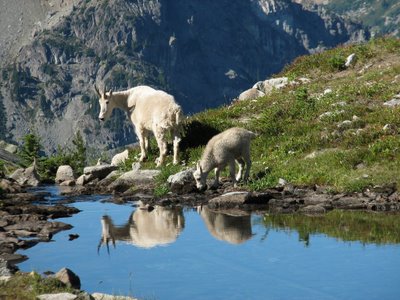
The next morning we got up early and took more pictures - for about 3 hours - before even eating breakfast. We met a fellow photographer who was there by himself - and agreed to swap photos once we returned home. While pumping water down by the lake we encountered some of the area's many resident mountain goats. They just sauntered down the trail, right past us, causing me to break out my camera in 2 seconds flat to take a ton of pictures. My favorite one is here:
Finally, we managed to eat breakfast, break camp, pack up our packs, and hit the trail at about 11:30. The way down was no easier than the way up - especially with packs on. We stopped at Tuck lake for a snack break and a chance to splash my face in the water (alas, no time to swim) and then proceeded on down. By the time we got to the flat part, we were pretty ready to be done - but we still had 4 miles to go. Towards the end of the trail we passed a large group that also included 2 horses. Finally, after crossing the aptly-named Skeeter Creek, we reached the trailhead and our car.
The ice cream bars and cherry cokes we had at the little general store we stopped at were to die for.
The rest of my pictures can be found here.
Thursday, August 17, 2006
Chinook salmon in the Ballard locks fish ladder
The first time I ever came to Seattle, my hosts took me to the Ballard Locks to witness the amazing movement of boats between two different bodies of water at different heights. It's all done without the use of pumps; pretty cool! We also walked over to the fish ladder - the series of pools of water through which spawning salmon can swim upstream in order to reach their breeding grounds - the other option being to jump over the dam (!), or to happen to pass through the locks. At that time there were no fish in the ladder, nor have there been on the handful of other times I've stopped by the locks to enjoy the view. Finally, this summer, I decided to go when the fish were there - which apparently also means that that is when the people are there too! I guess it was my own fault for going on a beautiful sunny Sunday afternoon in August.
Well, I have to say it was really worth it to finally see the salmon there. I missed the really big run of sockeye earlier in the month, but there were still plenty of chinook to be impressive. Apparently the coho run towards the end of the month, so you still have time to go and see them if you get a chance!
Wednesday, August 16, 2006
One of these things is not like the others
This weekend nyanko headed out of town with a note on the whiteboard: "Please eat my blueberries!" I decided this was a perfect opportunity to try making some blueberry muffins. Round #1, from my Better Homes and Gardens cookbook (top right in picture above), turned out to be fairly plain and boring - but still edible. Having never made blueberry anything before, I was surprised at the way the blueberries popped and drizzled upon baking.
For round #2, I googled for blueberry muffin topping and came up with a Bed and Breakfast website that had a recipe with a streusel topping. Differences from the first recipe included the addition of lemon yogurt, baking soda, and a few more blueberries (plus the yummy topping) making this batch much more fluffy and flavorful. I have one more aliquot of blueberries left in the fridge.... maybe I'll try making some blueberry coffee cake next!
Monday, August 07, 2006
Summerland
Yesterday nyanko and I went for another hike - one that was slightly more normal this time. We headed down to the eastern side of Mt. Rainier to hike to Summerland, along the Wonderland trail. The trail rose gradually through the forest, then switchbacked up a bit to reach the meadow at Summerland. The wildflowers were definitely amazing and the views of the mountain were glorious. While hiking the trail beyond Summerland, we looked back and saw a momma bear and two cubs crossing the trail - glad we were far away! Later we also saw a marmot (not a monkey), that wouldn't whistle despite me getting coming within 10 feet of it before it scurried away. The hike back down was uneventful (no ball bearings this time!).
Since we were in the area, and nyanko hadn't been to Sunrise before, we continued up the road to take in the views from up there. The meadows were full of beautiful purple lupine. The garden outside the visitor center helped us identify most of the varieties of wildflower we had seen on our hike - very helpful! On the drive home, I glanced back and saw the nearly-full moon rising over the mountain - a great ending to the day.
Wednesday, July 26, 2006
Summer in Seattle
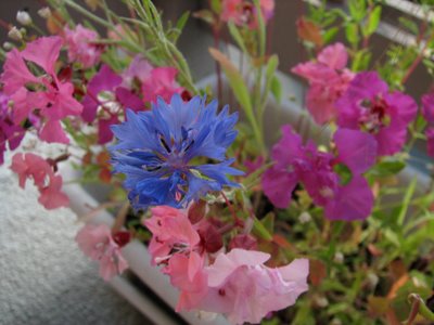
Well, summer is here and it's been hot, hot, hot. Unusually hot for our neck of the woods. Anyway, in the meantime, the flowers on my balcony have been putting on quite a nice show. Click here to see some pictures (Blogger is being stinky at the moment and won't let me upload the image)!
Update 1:04 pm 07/26/06:
Tuesday, July 25, 2006
Juxtaposition
Friday, July 21, 2006
Mailbox Peak
When trying to pick out a hike for last weekend, my roommate (nyanko) and I had a few criteria. We needed to be done by early afternoon, and I wanted it to be at least a little challenging, since I'm kinda sorta training for a much bigger hike later in the summer (TBD). Somehow this led us to choose Mailbox Peak, for its proximity (satisfying criterion #1) and for its steepness (#2). I had read many reviews, I KNEW that it was steep (the trail gains 4000 feet in 2.5 miles), but somehow, knowing doesn't seem to placate your muscles when the slope is so steep that your heels are no longer touching the ground. Ultimately, we made it to the top, and it was well worth the work. The views were awesome (we could see Mt. Rainier, Mt. Adams, possibly Mt. St. Helens, Puget Sound, the Olympics, Seattle, Mt. Si, Mt. Baker, and Glacier Peak, just to name a few...). The wildflowers were some of the best I've ever seen. There were, in fact, two mailboxes and a newspaper holder on the peak, as promised, but the fire hydrant that I'd heard about was no longer there. Our much anticipated lunch was extraordinarily yummy, especially because nyanko brought along cherries. A number of people, using the trail as a training hike, got to the top, dumped out the water weights they were carrying, and headed back down after only a few minutes' rest. Crazy! The way down was about as slow going as the way up - just because it was so steep! I tried to take some pictures to convey the steepness, but unless you were behind the camera, I think it's still hard to tell. Of course, it was also slow going because I had to stop every few steps to take more pictures of the wildflowers :). Once we were back in the forest (having successfully skirted the giant talus slope that we almost climbed up on the first part of the trip till someone came by and hollered that there was a way around), we reentered the forest and started following the green dots (trailmarkers, in this case). We had actually taken a lesser trail for part of the way up the hill, which had been marked with a set of older green dots - since it's not a maintained trail, it was easy to lose track of where the main trail was actually going. Anyway, we took the correct (or at least, more used) path back down the hill, though it wasn't too much better. Things got tricky when we got to the part where the trail was not only steep, but also covered in gravel, which acted like marbles or ball bearings, and wreaked havoc on our exhausted senses of balance. I actually fell several times, but with no major injuries. By the time we got back down to the flat forest road that lead back to the trailhead, we were overjoyed. Despite all the foibles and glitches, we had a great time and I'm glad we did it. But next time, we're definitely going to find a more "normal" trail. Click here for some more photos!
Monday, July 17, 2006
Surprise! Lake
Two weekends ago I headed up to the Stevens Pass area again, this time to go on a dayhike to Surprise Lake. The hike started out with a gradual climb through typical Northwest forest, then turned up a steeper hill to gain access to the lake. The water was crystal clear and quite chilly (I went in up to my knees). We ate lunch and enjoyed the scenery, then turned our boots downhill to head back to the cars at the trailhead. I brought up the rear of the group so that I could take advantage of the many wildflower photo opportunities! Click on the image below to see some more results!
Subscribe to:
Posts (Atom)